Back
Βρίσκεστε εδώ: Αρχική  Θέματα Εγκυκλοπαίδεια Στερεά Κατακρημνίσματα Τύποι και τρόποι ταυτοποίησης τους
Στερεά Κατακρημνίσματα Τύποι και τρόποι ταυτοποίησης τους


- Λεπτομέρειες
- Κατηγορία: Εγκυκλοπαίδεια
-
10 Jan 2013
- Συντάχθηκε από τον/την Μιχάλης Δρετάκης
- Προβολές: 5678
 Πολλές φορές,περιμένουμε τα χιόνια,αλλά δεν τα βλέπουμε με την κλασσική μορφή,αλλά κάτι παρεμφερή,μεταξύ χιονιου και χαλαζίου,ή παγιδίου.
Πιστεύω πολλές απο τις απορίες για τους τύπους αυτου του ενδιάμεσου που βλέπουμε μας τις λύνει ο φίλτατος εμπειρότατος συνάδελφος Μιχάλης Δρετάκης,κάτοικος στην πατρίδα αυτού του τυπου καιρού Β.Κρήτη,,που τα απότομα όρη-φράγματα της Κρήτης,δημιουργούν αναγκαστικό εμπόδιο,ανοδικότατων κινήσεων,έχοντας συνεχώς τέτοια χιονοπαράγωγα πολλές φορές εώς και την θάλασσα,όταν ο καιρός είναι πολύ ψυχρός,και το χιονι κατηφορίζει:
Στερεά Κατακρημνίσματα Τύποι και τρόποι ταυτοποίησης τους
Ενας παρατηρητής καιρού συχνά έχει να κάνει με μορφές υετού που δεν μπορεί εύκολα να τις κατατάξει
σε κάποια κατηγορία. Οι κατηγορίες υετού που συχνότερα συναντάμε είναι υγρής μορφής:
Ψεκάδα / Drizzle / DZ
Πρόκειται για σταγονίδιο υγρής μορφής με πολύ μικρή διάμετρο, κάτω από μισό χιλιοστό. Παρατηρείται
κατά κανόνα να πέφτει από στρωματόμορφα χαμηλά νέφη αλλά επίσης μερικές φορές και σε συνοδούς
στρωματίες των καταιγιδοφόρων νεφών και ακόμα σπανιότερα από άλλα υψηλά νέφη.
Βροχή / Rain / RN
Ό τυπικός τρόπος που πέφτει ο υετός με σταγόνες μεγαλύτερης διαμέτρου από 0,5mm.
Υπάρχουν επίσης το Παγοποιούμενη (πηγνυόμενη) βροχή / FreezingrainFRRN και το Παγοποιούμενη (πηγνυόμενη)
ψεκάδα / Freezingdrizzle/ FZDR. Πρόκειται για κανονική βροχή ή ψεκάδα που παγώνουν μόνο όταν φθάσουν το
έδαφος (όταν αυτό έχει αρνητική θερμοκρασία αντίθετα με τον υπερκείμενο αέρα). Πολύ σπάνιο φαινόμενο για την
Ελλάδα, σχεδόν αδύνατο να συμβεί στην πλειονότητα των σταθμών μας. Και όμως έχει καταγραφεί πολλές φορές
από παρατηρητές των αεροδρομίων μας να το βάζουν στα ΜΕΤΑΡ αντί για τα «χιονοχάλαζα»!
Από τα στερεά κατακρημνίσματα το πλέον γνωστό είναι το Χιόνι / Snow / SNπου πέφτει συνηθέστερα με τη μορφή
νιφάδων. Όλα τα στερεά κατακρημνίσματα μπορεί να πέφτουν ταυτόχρονα με υγρό υετό. Προκειμένου να τα
συζητήσουμε με λεπτομέρεια είναι καλό να δούμε τους κωδικούς των synops που πρέπει να καταγράφει ο
παρατηρητής. Οι κωδικοί ξεκινούν από το 00 και φθάνουν στο 99 και μόνο όποιοι μας ενδιαφέρουν αναφέρονται για
τα στερεά κατακρημνίσματα αναφέρονται παρακάτω:
Ξεκινώνταςαπότουςκωδικούς 20-29 (Precipitation, fog, ice fog or thunderstorm at the station during the preceeding hour
but not at the time observation.) Η κατηγορία 20-29 δεν έχει υετό την στιγμή της παρατήρησης αλλά περιγράφει τι έπεσε
πριν σε διάρκεια μιας ώρας. Τα 20-24 μιλούν για υετό χωρίς τη μορφή όμβρων:
Κωδικός 20 Drizzle (not freezing) or snow grains. Not falling as shower(s)
Στην παρατήρηση αυτή αναφερόμαστε σε ψεκάδα και στο αντίστοιχό της σε στερεά μορφή που είναι πολύ μικρό
κατακρήμνισμα για να το πούμε ακόμα και σφαιρίδιο, θα πρότεινα το «χιονοψεκάδα» και το ερώτημα είναι αν
πράγματι καταγράφεται ημέρα χιονόπτωσης αν τα δούμε να πέφτουν.
Παραθέτω ορισμούς που αναφέρονται στα snow grains:
Χιονοψεκάδα/ Snow Grains / SG
-
Frozen precipitation in the form of very small, white, opaque grains of ice. The solid equivalent of drizzle. It is reported as "SG" in an observation and on the METAR. -
Snow grains are small grains of ice. They do not produce much accumulation and are the solid equivalent to drizzle. -
Precipitation consisting of white, opaque ice particles usually less than one millimeter in diameter. -
snow grains—(Also called granular snow.) Precipitation in the form of very small, white opaque particles of ice; the solid equivalent of drizzle. They resemble snow pellets in external appearance, but are more flattened and elongated, and generally have diameters of less than 1 mm; they neither shatter nor bounce when they hit a hard surface. Descriptions of the physical structure of snow grains vary widely and include very fine, simple ice crystals; tiny, complex snow crystals; small, compact bundles of rime; and particles with a rime core and a fine glaze coating. It is agreed that snow grains usually fall in very small quantities, mostly from stratus clouds or from fog, and never in the form of a shower. -
Snow grains are a form of precipitation characterized as:-
white, opaque grains of ice -
very small <1 mm, -
fairly flat or enlongated, -
unlike Snow pellets they don't bounce or breakup on impact, -
very small amounts fall, mostly from Stratus or Fog, -
Never in the form of a shower.
-
The METAR code for snow grains is SG.
Με βάση τα παραπάνω η χιονοψεκάδα είναι στερεό κατακρήμνισμα με χαρακτηριστικά χιονιού που δεν αφήνει σημαντική
ποσότητα συνολικού υετού, μοιάζει με απλούς χιονοκρυστάλλους και όχι με νιφάδες, αποτελείται από μάλλον επίπεδα και
επιμηκισμένα σωματίδια μικρής διαμέτρου και δεν παρατηρείται σε περιπτώσεις όμβρων και καταιγίδων.
Κωδικός 23 Rain and snow or ice pellets. Not falling as shower(s)
Ο κωδικός περιγράφει περίπτωση ταυτόχρονης πτώσης βροχής και στερεού κατακρημνίσματος, το τελευταίο ως χιόνι
(εννοόντας νιφάδες και άρα έχουμε χιονόνερο) ή ως «παγοσφαιρίδια».
Παγοσφαιρίδια / Icepellets/ PE
Οι ορισμοί που αναφέρονται στα Παγοσφαιρίδια:
-
ICE PELLETS Precipitation in the form of transparent or translucent pellets of ice, which are round or irregular in shape.They have a diameter of 0.2 inches (5 mm) or less. They are classified into two types: hard grains of ice consisting of frozen raindrops or largely melted and refrozen snowflakes; pellets of snow encased in a thin layer of ice which have formed from the freezingof droplets intercepted by pellets or water resulting from the partial melting of pellets. It is reported as "PE" in an observation andon the METAR. Related term: sleet. -
Sleet / Ice Pellets (PE, PL, IP, SLT)- Sleet (Ice Pellets) are frozen raindrops that strike the earth's surface. In a sleet situation the precipitation aloft when it is first generated will be snow. The snow falls through a layer that is a little above freezing and the snow partially melts. If the snow completely melts it will be more likely to reach the earth's surface as supercooled water instead of sleet. If the snow partially melts there will still be ice within the falling drop for water to freeze on when the drop falls into a subfreezing layer. The lowest layer of the troposphere will be below freezing in a sleet situation and deep enough to freeze drops completely. The lower boundary layer can be above freezing and sleet occur if the sleet does not have time to melt before reaching the surface. -
Ice pellets A type of precipitation. Ice pellets or sleet are transparent or translucent spheres of frozen water that fall from clouds. Ice pellets have a diameter less than 5 millimeters. To form, this type of precipitation requires an environment where raindrops develop in an atmosphere where air temperature is above freezing. These raindrops then fall into a lower layer of air with freezing temperatures. In this lower layer of cold air, the raindrops freeze into small ice pellets. Like freezing rain, an air temperature inversion is required for development of ice pellets. -
ice pellets—A type of precipitation consisting of transparent or translucent pellets of ice, 5 mm or less in diameter.  They may be
spherical, irregular, or (rarely) conical in shape. Ice pellets usually bounce when hitting hard ground and make a sound upon impact.
Now internationally recognized, ice pellets includes two basically different types of precipitation, known in the United States as
1) sleet and 2) small hail. Thus a two-part definition is given: 1) sleet or grains of ice, generally transparent, globular, solid grains of
ice that have formed from the freezing of raindrops or the refreezing of largely melted snowflakes when falling through a
below-freezing layer of air near the earth's surface; 2) small hail, generally translucent particles, consisting of snow pellets encased
in a thin layer of ice. The ice layer may form either by the accretion of droplets upon the snow pellet or by the melting and refreezing
of the surface of the snow pellet. Compare hail, graupel.
Παγοσφαιρίδια έχουμε λοιπόν σύμφωνα με τους παραπάνω ορισμούς σε δύο αρκετά διαφορετικές περιπτώσεις. Για τον
κωδικό 23 όμως μιλάμε για υετό στρωματόμορφων νεφών. Είναι γενικά αρκετά μεγαλύτερα σε διάμετρο από τη «χιονοψεκάδα».
Ο πρώτος τύπος (sleet των Αμερικανών) προκύπτει από εντελώς λιωμένες νιφάδες χιονιού* που ξαναπαγώνουν σε ένα
ενδιάμεσο επίπεδο και δεν προλαβαίνουν να ξαναλιώσουν φθάνοντας στο έδαφος με αποτέλεσμα να αναπηδούν εύκολα πριν
λιώσουν στις θερμότερες επιφάνειες. ΔΕΝ ΕΙΝΑΙ Ο ΧΑΡΑΚΤΗΡΙΣΤΙΚΟΣ ΥΕΤΟΣ ΠΟΥ ΒΛΕΠΟΥΜΕ ΜΕ ΧΙΟΝΟΚΑΙΡΟ
ΒΟΡΕΙΟΥ ΡΕΥΜΑΤΟΣ ΣΤΑ ΑΝΑΤΟΛΙΚΑ ΠΡΟΣΗΝΕΜΑ ΤΟΥ ΑΙΓΑΙΟΥ ΚΑΙ ΣΤΗΝ ΚΡΗΤΗ. Είναι κάτι σαν «ξηρός
χιονόλυτος», ίσως τυπικός στρωματόμορφων νεφών που δίνουν χιόνι σε μεγαλύτερα υψόμετρα και βροχή χαμηλότερα, στο
ενδιάμεσο στάδιο αντόι για χιονόνερο ή χιονόλυτο μπορεί να πέφτουν αυτά.
(* ή και από βροχή που πάγωσε στον αέρα, όχι στο σύννεφο, αλλά μάλλον δεν μας αφορά στην Ελλάδα! φαινόμενο βορείων
ωκεανών μοιάζει)
Ο δευτερος τύπος (smallhail) είναι μια μάζα πάγου που ενσωματώνει γύρω του ψήγματα χιονονιφάδων από το νέφος.
Λογικά όμως αυτός ο τύπος δεν συναντάται σε στρωματόμορφα νέφη αλλά αυτό μένει αδιευκρίνστο! Πιθανολογώ ότι
πρόκειται για παρανόηση και είτε έχουμε στην πραγματικότητα χιονοχάλαζο (βλέπε παρακάτω) από μονάδα νέφους
αστάθειας μέσα στα στρωματοφόρα νέφη είτε έχουμε απλά μεγαλύτερο παγοσφαιρίδιο που αποσπά κάποιες νιφάδες.
Κωδικοί 36-39 (drifting or blowing snow)
Κατηγορίες που δεν αντιστοιχούν σε υετό (κατακρήμνισμα από νέφη) αλλά σε περιπτώσεις ματαφοράς και ανύψωσης στρωμένου
χιονιού.
Μεταφερόμενοχιόνι
36 Slight or moderate drifting snow. Generally low (below eye level)
37 Heavy drifting snow. Generally low (below eye level)
Ανυψούμενοχιόνι
38 Slight or moderate blowing snow. Generally high (above eye level)
39 Heavy blowing snow. Generally high (above eye level)
Κωδικοί 68-69 που καταγράφονται στη γενική κατηγορία βροχής (Rain)
68 Rain or drizzle and snow, slight
69 Rain or drizzle and snow, moderate or heavy
όπως φαίνεται από τα πάραπάνω όταν έχουμε χιονόνερο δίνουμε μάλλον βροχόπτωση και όχι χιονόπτωση!
Κωδικοί 70-79 (Solid precipitation not in showers) αντιστοιχούν σε ΣΤΕΡΕΑ ΚΑΤΑΚΡΗΜΝΙΣΜΑΤΑ αλλά μόνο οι 70-75
αντιστοιχούν σε τυπική χιονόπτωση με νιφάδες (snowflakes). Τα κατακρημνίσματα γνωστά ως στούπα, πατσαβούρια και όλα
τα συναφή όμορφα και αθόρυβα στερεά κατακρημνίσματα που αποτελούν την πλέον γνώριμη μορφή χιονιού.
Χιόνι / Snow (SN, SNW, S)
Να ορισμοί για το τυπικό χιόνι:
-
Snow is an aggregate of ice crystals that form into flakes. Snow forms at temperatures below freezing. For snow to reach the earth's surface the entire temperature profile in the troposphere needs to be at or below freezing. It can be slightly above freezing in some layers if the layer is not warm or deep enough the melt the snow flakes much. The intensity of snow is determined by the accumulation over a given time. Categories of snow are light, moderate and heavy. -
Snow - A type of solid precipitation that forms in clouds with an air temperature below freezing. Snow forms when water vapor
deposits directly as a solid on a deposition nuclei. Snowflakes begin their life as very tiny crystals developing on a six-sided
hexagonal deposition nuclei. The developing snowflak, then grows fastest at the six points of the nuclei as these surfaces are
more exposed to atmosphere's water vapor. Snowfall is most common with the frontal lifting associated with mid-latitude
cyclones during fall, winter, and spring months when air temperatures are below freezing.
Και για τις νιφάδες χιονιού:
SNOWFLAKES An ice crystal or an aggregate of ice crystals which fall from clouds. snowflake—Colloquially an ice crystal, or more
commonly an aggregation of many crystals that falls from a cloud. Simple snowflakes (single crystals) exhibit beautiful variety of form,
but the symmetrical shapes reproduced so often in photomicrographs are not found frequently in snowfalls. Broken single crystals,
fragments, or clusters of such elements are much more typical of actual snow. Snowflakes made up of clusters of crystals (many
thousand or more) or crystal fragments may grow as large as three to four inches in diameter, often building themselves into hollow
cones falling point downward.  In extremely still air, flakes with diameters as large as 10 inches have been reported.
Σύμφωνα με τα παραπάνω οτιδήποτε κοκκώδες υετομόρφωμα δεν είναι χιόνι! Μόνο οι νιφάδες δικαιούνται αυτόν τον
χαρακτηρισμό! Αυτό πραγματικά ξενίζει πολλλούς ασχολούμενους με τον καιρό και εραστές των καιρικών φαινομένων
που είναι «χιονοκοκκοαναθρεμμένοι»!
Οι κωδικοί των synops συνεχίζουν με σπανιότερα κατακρημνίσματα, ακόμη αναφερόμενοι σε υετό χωρίς μορφή όμβρων:
76 Diamond dust (with or without fog)
Παγοκρύσταλλοι / Ice Crystals (diamond dust) / IC
Παρακάτω τρεις ορισμοί, ο τρίτος μάλλον δεν αναφέρεται σε υετό αλλά στη μορφή του παγοκρύσταλλου στο σύννεφο:
-
ICE CRYSTALS = Precipitation in the form of slowly falling, singular or unbranched ice needles, columns, or plates. They make up cirriform clouds, frost, and ice fog. Also, they produce optical phenomena such as halos, coronas, and sun pillars. May be called "diamond dust." It is reported as "IC" in an observation and on the METAR. -
Ice Crystals (IC)- Also called diamond dust. They are small ice crystals that float with the wind. -
ice crystal—Any one of a number of macroscopic, crystalline forms in which ice appears, including hexagonal columns, hexagonal
platelets, dendritic crystals, ice needles, and combinations of these forms. The crystal lattice of ice is hexagonal in its symmetry
under most atmospheric conditions. Varying conditions of temperature and vapor pressure can lead to growth of crystalline
forms in which the simple hexagonal pattern is present in widely different habits (a thin hexagonal plate or a long thin hexagonal
column). In many ice crystals, trigonal symmetry can be observed, suggesting an influence of a cubic symmetry. The principal
axis (c axis) of a single crystal of ice is perpendicular to the axis of hexagonal symmetry. Planes perpendicular to this axis are
called basal planes (a axes related to the prism facets) and present a hexagonal cross section. Ice is anisotropic in both its optical
and electrical properties and has a high dielectric constant (even higher than water) resulting from its water dipole structure. The
electrical relaxation time for water is much shorter than for ice (109 Hz compared with 104 Hz), resulting from a chain reaction
requirement for molecules to relax through defects in the ice lattice. In the free air, ice crystals compose cirrus-type clouds, and
near the ground they form the hydrometeor called, remarkably enough, “ice crystals” (or ice prisms). They are one constituent of
ice fog, the other constituent being droxtals. On terrestrial objects the ice crystal is the elemental unit of hoarfrost in all of its various
forms. Ice crystals that form in slightly supercooled water are termed frazil. Ice originating as frozen water (e.g., hail, graupel, and
lake ice) still has hexagonal symmetry but lacks any external hexagonal form. Analysis of their sections (0.5 mm) in polarized light
reveals different crystal shapes and orientations, depending on the freezing and any annealing and subsequent recrystallization process.
Προκύπτει λοιπόν ότι για να έχουμε αιωρούμενους Παγοκρύσταλλους ως υετό απαιτούνται πολύ χαμηλές θερμοκρασίες και
ιδιαίτερα ξηρή ατμόσφαιρα. Πρόκειται ασφαλώς για υετό που βλέπουν οι Εσκιμώοι και ίσως κανένας χειμερινός ορειβάτης
στον Όλυμπο και σε άλλα ψηλά βουνά!!
77 Snow grains (with or without fog)
Χιονοψεκάδα – μιλήσαμεήδηγιααυτήν
78 Isolated star-like snow crystals (with or without fog)
Χιονοκρύσταλλοι / Snow Crystals
Για αυτόν τον τύπο ένας ορισμός:
snow crystal—Any of several types of ice crystal found in snow. A snow crystal is a single crystal, in contrast to a snowflake, which is
usually an aggregate of many single snow crystals.
Δηλαδή έχουμε πτώση απλών κρυστάλλων που «κανονικά» θα έφτιαχναν νιφάδες. Η πιθανή διαφορά από τους
παγοκρυστάλλους είναι το ακόμα μικρότερο μέγεθος αλλά δεν ξέρω γιατί το synop αυτό ξεχωρίζει μόνο αυτούς που
πέφτουν ως αστερόμορφοι.
78 Ice pellets
Για τα παγοσφαιρίδια έχω ήδη αναφερθεί.
Κωδικοί 80-99(Showery precipitation, or precipitation with current or recent thunderstorm)
Και πάμε στα δυσκολότερα και λιγότερο αποσαφηνισμένα που είναι οι υετοί με τη μορφή όμβρων και καταιγίδων!
Στον υετό τύπου 87 και 88 αναφέρονται για πρώτη φορά τα snow pellets και ξανά το smallhail με διαφορετική ένοια από το
“icepelllets” των κωδικών 23 και 79 αφού τώρα υπάρχουν βίαια και απότομα φαινόμενα όμβρων.
Κωδ. 87 Shower(s) of snow pellets or small hail with or without rain or rain and snow mixed, slight
Κωδ. 88 Shower(s) of snow pellets or small hail with or without rain or rain and snow mixed, moderate or heavy
Στους κωδικούς 89 και 90 αναφέρεται το “hail”
Κωδ. 89 Shower(s) of hail with or without rain or rain and snow mixed, slight
Κωδ. 90 Shower(s) of hail with or without rain or rain and snow mixed, moderate or heavy
Τα 87-90 αναφέρονται σε περιπτώσεις απλών όμβρων, όχι καταιγίδας την ώρα της παρατήρησης. Στα 93, 96, 99 όμως
υπάρχει καταιγίδα (σε εξέλιξη ή προηγήθηκε) και το “hail” περιλαμβάνει οτιδήποτε από τα «Hail, smallhail, snowpellets»
κάτι που δεν συμβαίνει με τις περιπτώσεις 89 και 90!
Κωδ. 93 Slight snow, or rain and snow mixed, or hail at time of observation
Κωδ. 96 Thunderstorm, slight or moderate, with hail at time of observation
Κωδ. 99 Thunderstorm, heavy, with hail at time of observation
Ερπιπλέον στην ακραία περίπτωση του κωδικού 94 το “hail” αναφέρεται σε περιπτώσεις με κάποιο στρόβιλο και δεν
θεωρεί ότι ενσωματώνει και τις άλλες κατηγορίες!
Κωδ. 94 Moderate or heavy snow, or rain and snow mixed, or hail at time of observation Tornado cloud or waterspout
Βλέπουμε λοιπόν ότι δεν είναι ξεκάθαρο τι εννοούμε με το hail αν μείνουμε στους κωδικούς των synops.
Ας πάμε στους ορισμούς με την ελπίδα να τα αποσαφηνήσουμε.
Τι είναι Χαλάζι / Hail (GR, A);
-
HAIL Precipitation that originates in convective clouds, such as cumulonimbus, in the form of balls or irregular pieces of ice, which comes in different shapes and sizes. Hail is considered to have a diameter of 5 millimeter or more; smaller bits of ice are classified as ice pellets, snow pellets, or graupel. Individual lumps are called hailstones. It is reported as "GR" in an observation and on the METAR. Small hail and/or snow pellets is reported as "GS" in an observation and on the METAR. -
Hail (GR, A)- Hail is dense precipitation ice that is that least 5 millimeters in diameter. It forms due to ice crystals and supercooled water that freeze or stick to the embryo hail stone. Soft hail is more white and less dense since it has air bubbles. Soft hail occurs when hail grows at a temperature below freezing by ice crystals and small supercooled water and cloud droplets merging onto the hail. Hard hail occurs when liquid water drops freeze on the outer edges of the hailstone after the outer edge is above freezing. The freezing of supercooled water releases latent heat and this can result in the outer edge of the hail stone warming above freezing. Then the waterrefreezes creating solid ice. Hail will commonly have soft ice and hard ice layers when it is sliced open. -
hail—Precipitation in the form of balls or irregular lumps of ice, always produced by convective clouds, nearly always
cumulonimbus. An individual unit of hail is called a hailstone. By convention, hail has a diameter of 5 mm or more,
while smaller particles of similar origin, formerly called small hail, may be classed as either ice pellets or snow pellets.
Thunderstorms that are characterized by strong updrafts, large liquid water contents, large cloud-drop sizes, and
great vertical height are favorable to hail formation. The destructive effects of hailstorms upon plant and animal life,
buildings and property, and aircraft in flight render them a prime object of weather modification studies. Inaviationweather observations, hailisencodedA.
Με βάση τα παραπάνω χαλάζι είναι ότι στερεό κατακρήμνισμα είναι περισσότερο από 5mm σε διάμετρο! Αρκεί αυτό;
Δεν υπάρχουν άραγε snow pellets μεγαλύτερα από 5mm; Υπάρχουν βεβαίως και οι μαρτυρίες για αυτό είναι πολλές!
Θεωρείται επίσης από πολλούς ότι η έννοια small hail είναι ατυχής { smallhail: hailwithadiameterlessthan 0.64 cm
(0.25 in.) }και τα μικρότερα χαλαζοειδή τα λένε ice pellets, snow pellets. Προφανώς χαλάζι δεν είναι όσα
κατακρημνίσματα έχουν διάκενα αέρα και είναι μαλακά, πέρα από το διαφορετικό τρόπο δημιουργίας. Το
καλύτερο είναι να διαχωρίζουμε το χαλάζι από άλλα σχετικά μεγάλα και κοκκώδη στερεά κατακρημνίσματα με
βάση τη μορφή του στο έδαφος. Το (πραγματικό) χαλάζι είναι ενιαίο κομμάτι πάγου, πολύ σκληρό και ικανό να
προκαλέσει ζημιές. Δεν έχει διάκενα αέρα, ή έχει ασήμαντα, αναπηδά ,ζωηρά και δεν σπάει αμέσως όταν πέσει
στο έδαφος. Δεν είναι άσπρο, αλλά μάλλον διάφανο ακόμη και αν είναι ιδιαίτερα χοντρό.
Και τι είναι τελικά τα περίφημα snow pellets; και τι είναι καλό (ή δεν είναι!) να λέμε χιονοχάλαζο; που είναι γραμμένος
ένας κωδικός για αυτό; που εντάσσονται οι ωραίοι χιονόκοκκοι όπως το ρυζόχιονο, το ρεβυθόχιονο και άλλα ωραία
κοκκώδη κατακρημνίσματα που στην υφή τους είναι πέρα για πέρα αγνό χιονάκι; Για να δούμε!
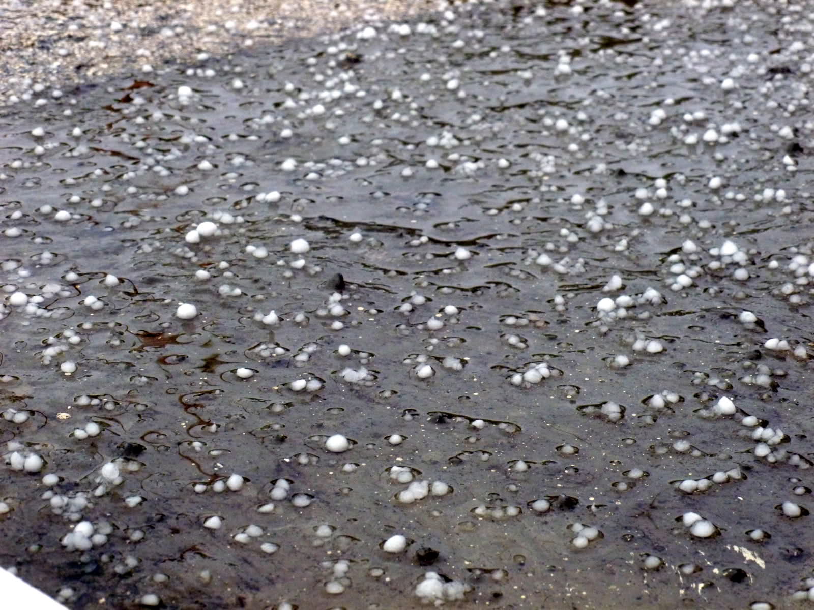
Χιονοσφαιρίδια και Χιονοχάλαζο / Snow Pellets / GS
Οι ορισμοί για τα snow pellets είναι αρκετά διαφορετικοί μεταξύ τους και δείχνουν ότι δεν έχουν πλήρως καταγραφεί
όλοι οι πραγματικοί τύποι στερεών κατακρημνισμάτων:
-
SNOW PELLETS Frozen precipitation in the form of white, round or conical opaque grains of ice. Their diameter ranges from 0.08 to 0.2 inch (2 to 5 mm). They are easily crushed and generally break up after rebounding from a hard surface, unlike hail. Sometimes it is called small or soft hail. It is reported as "GS" in an observation and on the METAR. -
Snow Pellets (GS)- A snow pellet is precipitation that grows by supercooled water accreting on ice crystals or snow flakes. Snow pellets can also occur when a snowflake melts about half way then refreezes as it falls. Snow pellets have characteristics of hail, sleet and snow. With sleet (ice pellets), the snowflake almost completely melts before refreezing thus sleet has a hard ice appearance. Soft hail grows in the same way snow pellets can grow and that is ice crystals and supercooled water accreting on the surface. Snow pellets will crush and break apart when pressed. They can bounce off objects like sleet does. Snow pellets have a whiter appearance than sleet. Snow pellets have small air pockets embedded within their structure and have visual remnants of ice crystals unlike sleet. Snow pellets are typically a couple to several millimeters in size. -
snow pellets—(Also called soft hail, graupel, tapioca snow.) Precipitation consisting of white, opaque, approximately round (sometimes conical) ice particles having a snowlike structure, and about 2–5 mm in diameter. Snow pellets are crisp and easily crushed, differing in this respect from snow grains. They rebound when they fall on a hard surface and often break up. In most cases, snow pellets fall in shower form, often before or together with snow, and chiefly on occasions when the surface temperature is at or slightly below 0°C (32°F). It is formed as a result of accretion of upercooled droplets collected on what is initially a falling ice crystal (probably of the spatial aggregate type). -
Snow pellets are a form of precipitation in which snow flakes partially melt and lose their flake structure as they fall into warm air, then re-freeze as they pass back into colder air, forming amorphous or semi-crystalline pellets of snow. It may also be known as soft hail. The METAR code for Snow Pellets is GS. Description Snow pellets are typically 1-5 mm in diameter and are distinct from true hail in that they are not composed of concentric layers of solid ice. Snow pellets usually retain the tiny air pockets of the original snowflake, making them white and softer than hail. Snow pellets are also distinct from ice pellets and snow grains in that they retain a soft structure and surface, while the surface of an ice pellet is smooth and hard. * white, * opaque particle of ice, * 2–5 mm in diameter, * spherical or conical in shape, * brittle and easy to crush, * they bounce and can breakup on impact, * usually occur in showers, * often fall with snow flakes or rain when the surface temperature is around 0°C. Formation Snow pellets commonly form in clouds on cold fronts where high air turbulence increases the possibility of snowflakes passing through successive currents of warm and cold air on descent. The snow produced by snow cannons closely resembles snow pellets. -
Snow Pellets     A form of precipitation also known as graupel. Snow pellets are white, spherical bits of ice with a
maximum diameter of 5 millimeters. Snow pellets develop when supercooled droplets freeze on snowflakes. Snow
pellets often fall for a brief time period when precipitation transforms from ice pellets to snow. Snow pellets can be
easily distinguished from packed snowflakes as they tend to bounce when they strike the ground. Packed
snowflakes are not dense enough to cause them to bounce.
Τι προκύπτει λοιπον από αυτούς τους 5 ορισμούς;
Ο 1ος δίνει μια εξήγηση που ταιριάζει αρκετά με το «σκληρό χιονοχάλαζο» που παρουσιάζεται συχνά στην
κεντρονότια πεδινή Ελλάδα και τα νησιά. Είναι μαλακότερο και μικρότερο του χαλαζιού και για αυτό αντιστοιχεί
σε soft-small hail. Φυσικά το διακρίνουμε από τα τα ice pellets/sleet γιατί στην περίπτωση των συζητούμενων
κωδικών έχουμε αστάθεια και όμβρους και όχι στρωματοφόρα νέφη! Είναι όμως σαφές ότι δεν είναι ice
pellets/sleet = ξηρός χιονόλυτος» στην πλειονότητα των περιπτώσεων που αφορούν την πεδινή χώρα μας καθώς
κατά κανόνα δεν παρεμβάλλονται στα χαμηλά στρώματα αέρα αρνητικές θερμοκρασίες.
Ο ορισμός 2 περιλαμβάνει και τα σκληρά και τα μαλακά χιονοχάλαζα! Δεν περικλείει αναγκαστικά περιορισμό
διαμέτρου.
Ο ορισμός 3 μας διαφωτίζει αρκετά τι πραγματικά εννοούν οι μετεωρολόγοι στις βόρειες χώρες με την ένοια snow
pellets. Μιλούν για περιπτώσεις θερμοκρασιών κοντά ή κάτω από τους 0oCστην επιφάνεια! Μήπως αγνοούν την
περιπτωσή μας;
Ο 4 ορισμός είναι αυτός που ταιριάζει καλύτερα για το μαλακό χιονοχάλαζο, αλλά (κακώς!) βάζει περιορισμούς
διαμέτρου και θερμοκρασίας αέρα!
Αλλά είναι ο ορισμός 5 που κάνει μια πολύ χρήσιμη διάκριση. Εδώ αναφέρονταιταπακέταχιονονιφάδων!
(packed snowflakes): Snow pellets can be easily distinguished from packed snowflakes as they tend to bounce when
they strike the ground. Packed snowflakes are not dense enough to cause them to bounce. Δηλαδή τα πακέτα
χιονονιφάδων είναι ακαθόριστης υφής και μπορεί να διαλύονται σε νιφάδες όταν πέφτουν. Υετός που κανείς
δεν μπορεί να μην χαρακτηρίσει καθαρή χιονόπτωση!
Προτείνω 3 ορισμούς
Χιονοχάλάζο είναι το άσπρο (αν και λίγο διαφανές) σκληρό (αλλά όχι τόσο σκληρό όσο το χαλάζι) και σχετικά
μικρό στερεοκατακρήμνισμα (μικρό snow pellet - small hail). Κυρίως μοιάζει με παγάκι αλλά με διάκενα αέρα,
χωρίς ευδιάκριτες νιφάδες. Αντιστοιχεί στο soft hail και όχι στο ice pellet που πάντα προέρχεται από στρωματοφόρα
νέφη. Αναπηδά πολύ (όχι όμως σαν το χαλάζι!) και δεν καταφέρνει να στρωθεί στο έδαφος ακόμα και όταν ρίχνει
μεγάλη ποσότητα. Η  τυχόν ημέρα παρατήρησής του καλό είναι να αναφέρεται ως ημέρα χιονοχάλαζου!
Xιονοσφαιρίδιο είναι το άσπρο, μαλακό και συχνά αρκετά μεγάλο snow pellet. Διαθέτει μεν πυρήνα με παγάκι
και διάκενα αέρα (που το κάνει αρκετά ανάλαφρο και μπορεί να παίζει με τον άνεμο) αλλά διαθέται και μεγάλο
στρώμα νιφάδων, μερικές φορές ευδιάκριτων όταν το κόψουμε στα 2. Αν και αναπηδά λίγο, προσκολάται
ευκολότερα από μτο χιονοχάλαζο σε σταθερά αντικείμενα και στρώνεται εύκολα, παραμένει δε μεγάλο
χρονικό διάστημα χωρίς να λιώσει σε θερμοκρασίες ακόμα και αρκετά πάνω από το 0. Η  τυχόν ημέρα
παρατήρησής του καλό είναι να αναφέρεται επίσης ως ημέρα χιονοχάλαζου εκτός αν έχουν πέσει και
καθαρές χιονονιφάδες μαζί και επίσης αν υπάρχει σταθερό στρώσιμο οπότε έχουμε ημέρα χιονόπτωσης!
Και τα 2 παραπάνω αντιστοιχούν στο snowpellet και έχουν να κάνουν με υετό από νέφη αστάθειας. Συνήθως
έχουν μικρή διάρκεια και προηγούνται καθαρής χιονόπτωσης αλλά σε νησιωτικές περιοχές έρχονται μαζί ή
προηγούνται βροχής. Δεν έχουν άμεση σχέση με το χαλάζι και πρέπει να διαχωρίζονται. Το τυπικό χαλάζι
κατά κανόνα προέρχεται μόνο από μεγάλα νέεφη κατακόρυφης ανάπτυξης, Cb, κυρίως θερμικών καταιγίδων
ή ψυχρών μετώπων, ενώ τα παραπάνω μπορεί να προέρχονται από πολύ μικρότερα σε κατακόρυφη ανάπτυξη
νέφη «χειμερινού» τύπου, με μετωπική ή όχι δραστηριότητα.
«Χιονοπακέτο» (πρέπει να βρεθεί καταλληλότερη λέξη!) = Δεν είναι snow pellet. Δεν είναι αναγκαστικά
σφαιρικό, μπορεί να έχει διάφορα σχήματα, ωοειδές ή κυλινδρικό! Είναι το πολύ γνωστό κοκκώδες
κάτασπρο χιόνι από συγχωνεμένες νιφάδες που μπορούν να δημιουργήσουν μια μπαλίτσα ή άλλο σχήμα πολύ
σημαντικού μεγέθους. Μπορεί να ξεχωρίσει από τα χιονοσφαιρίδια από το γεγονός ότι δεν αναπηδά σχεδόν
καθόλου και συχνά θρυματίζεται σαν πέφτει αποκλαύπτοντας τις χιονονιφάδες! Φυσικά μπορεί να έχουμε σε μια
περιοχή αναπηδόντα χιονοχάλαζα που θα προλάβουν να στρωθούν και να ακολουθήσουν χιονοπακέτα ή απλές
νιφάδες! Σύμφωνα με τους κωδικούς δεν είναι snow pellet και το μόνο που μπορεί να είναι είναι αγνό χιονάκι!
Ημέρα χιονόπτωσης χωρίς αμφιβολία! Γιατί όμως το «Packed snowflakes» δεν αναφέρεται ως κάτι διαφορετικό
στους συνοπτικούς κωδικούς;
Το δυσκολότερο στο να ορίσει κανείς μια ημέρα ως ημέρα χιονόπτωσης είναι όταν έχει στρωμένο «χιόνι»,
ακόμα και σημαντική ποσότητα το οποίο όμως έχει πέσει όλο με τη μορφή χιονοσφαιριδίων. Είναι μια πολύ
συχνή περίπτωση στην Κρήτη, στην Ευβοια και πιθανότατα και σε άλλα μέρη. Με το δεδομένο ότι υπάρχει
στρωμένο αντικείμενο είναι μάλλον «αναγκαστικό» να αναγράφεται ως ημέρα χιονόπτωσης.
Ναι αλλά με αυτά έχουμε τελειώσει με τα στερεά κατακρημνίσματα; Αποδίδονται όλες οι μορφές υετού που
βλέπουμε στον τόπο μας; Αρκούν οι ορισμοί οι παραπάνω στην περιγραφή δημιουργίας τους;. Πολύ φοβάμαι
πως όχι! Διάφορα ενδιάμεσου τύπου στερά κατακρημνίσματα μπορεί κάποιος να δει στην Ελλάδα. Ο ρόλος
ακόμα και του αλατιού της θάλασσας μπορεί να καθορίζει τη μορφή και το σχηματισμό τους, και αυτή τη
θεωρία την έχει αναπτύξει με θαυμάσιο τρόπο ο φίλος Γιάννης Παπαδόπουλος στην Ελληνική Λίστα
Καιρόφιλων (HellasWeatherGroup). Είναι εντυπωσιακό πόσο αλάτι παραμένει όταν πέφτει με βόρεια
ρεύματα στη βόρεια Κρήτη στερεό κατακρήμνισμα, είτε τυπικό χιόνι είτε κάποιο κοκκώδες. Η πραγματική
φύση δημιουργίας των στερεών κατακρημνισμάτων που γεννάει το Αιγαίο και οι μορφές που τελικά θα πάρει
ο υετός στο έδαφος πρέπει να μελετηθούν σε βάθος. Αν οι Εσκιμώοι έχουν 100 λέξεις για το χιόνι μήπως και
 μεις πρέπει να εφεύρουμε κάπως περισσότερες για τα στερεά μας κατακρημνίσματα;
Μιχάλης Δρετάκης
Βιολόγος
Ερασιτέχνης Παρατηρητής Καιρού
Ηράκλειο Κρήτης, 8 Φεβρουαρίου 2007.
Πηγές διαδικτύου:
Μιχάλης Δρετάκης
Βιολόγος
Ερασιτέχνης Παρατηρητής Καιρού
Ηράκλειο Κρήτης, 8 Φεβρουαρίου 2007.

Σχόλια
Τροφοδοσία RSS για τα σχόλια αυτού του άρθρου.